 Abel Tasman Park Tours
Home › Guides › Abel Tasman Coast Track: How Do You Walk It in a Day or in 3 to 5 Days?
Abel Tasman Coast Track: How Do You Walk It in a Day or in 3 to 5 Days?
The Abel Tasman Coast Track is 60 km one way and takes 3 to 5 days on foot, or one section in a day by combining a boat ride with a walk. This Abel Tasman Coast Track guide covers section times, tides, huts, getting there and the tours that match each stretch.
Quick answer Length, days and day-walk options
The track is 60 km one way and DOC gives 3 to 5 days. Most people sleep in huts or campsites, and anyone short of time can ride a water taxi to a middle bay and walk part of it.
Key takeaways
- Plan 3 to 5 days for the full 60 km, or see the 3 Day Abel Tasman Guided Walk at $979.16.
- One tidal crossing is compulsory, so build the day around the Awaroa Inlet low tide window.
- Huts and campsites must be booked all year, see the fee table before you pick dates.
- For one day only, pair a boat with a walk using abel tasman national park tours.
Multi-Day Coast Track Trips Compared
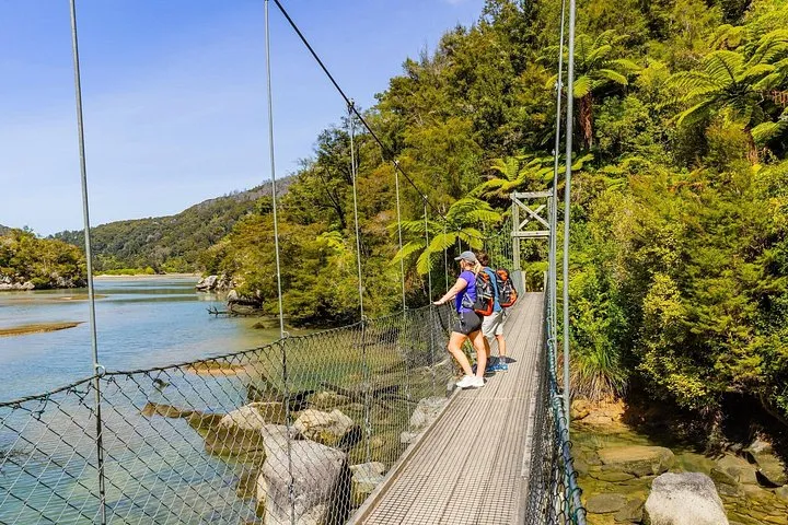 from $979.16
Guided walk
3 Day Abel Tasman Guided Walk
Lodge-to-lodge guided walk over 3 days with bags moved by boat, no refund once booked.
Check Availability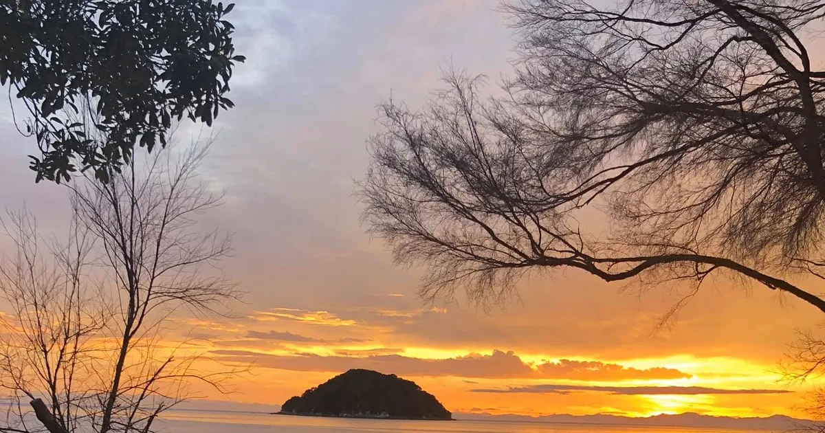 from $755
Catered camping
3-Day Fully Guided Catered Kayak and Camping Tour
Two nights camping on the beach with all meals and gear provided, paddling Awaroa to Marahau in a group of up to 10.
Check Availability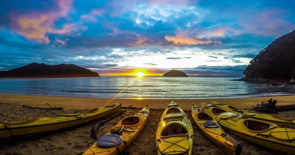 from $184
Abel Tasman: Self-Guided 3-Day Kayak and Walk
Three days, two paddling to Onetahuti, then a walk to Totaranui and a water taxi home, no guide after the briefing.
Check AvailabilityHow long does it take to walk the Abel Tasman Coastal Track?
DOC gives 3 to 5 days one way for the 60 km, and most walkers take 4.
Most walkers take 4 days and sleep in huts or campsites. Days run 4 to 6 hours of walking, and the track is graded intermediate. Boats to the start of each section are compared on Abel Tasman water taxi, and beds along the way on Abel Tasman accommodation.
Section times and distances
This table lists each stretch from south to north with the distance and time DOC gives, so you can see where a 3, 4 or 5 day plan splits. Two sections have a tide-dependent choice, covered below.
| Section | Distance | Time | What decides the day |
|---|---|---|---|
| Marahau to Anchorage | 12.4 km | 4 hr | Mostly forest and bays |
| Anchorage to Bark Bay (high tide track) | 11.5 km | 4 hr | All-tide route |
| Anchorage to Bark Bay (low tide route) | 8.4 km | 3 hr | Crosses Torrent Bay estuary |
| Bark Bay to Awaroa | 13.5 km | 4 hr 30 min | Longest day on the track |
| Awaroa to Totaranui | 7.1 km | 2 hr 20 min | Tidal |
| Totaranui to Whariwharangi Bay | 9.8 km | 3 hr 15 min | North end of the Great Walk |
| Whariwharangi Bay to Wainui | 5.7 km | 2 hr | Walk-only exit |
| Whariwharangi Bay to Totaranui via Gibbs Hill | 9 km | 3 hr | Links back to the water taxi |
A 3, 4 or 5 day plan
DOC gives Marahau to Anchorage as 12.4 km and 4 hr, so a fit group can stack the first two days. A 4 day plan uses huts at Anchorage, Bark Bay and Awaroa, then a short last day to Totaranui and a water taxi back. DOC says you can walk the track in either direction and use a water taxi or kayak between locations.
If you want a guide to carry the logistics, the 3 Day Abel Tasman Guided Walk runs 3 days and 2 nights from Wilsons Abel Tasman and is listed at $979.16 per person. It has a 4.9 rating from 14 reviews and no refund, all sales final.
Source: Department of Conservation.
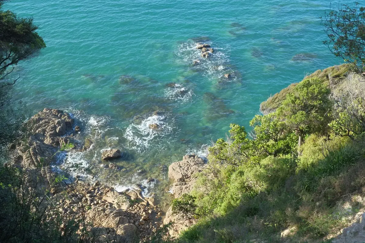
The track climbs above rocky headlands, so expect views like this between the beaches. Photo: Pseudopanax at English Wikipedia, Public domain, via Wikimedia Commons
Abel Tasman Coast Track Map
The track runs 60 km from Marahau to Wainui. Pins mark the huts, the water taxi stops and the two tidal crossings that decide your timing.
Pin positions from OpenStreetMap. The Coast Track line is drawn between stops and is approximate.
Which direction should I walk it?
Either direction works, and most itineraries run south to north from Marahau to Totaranui or Wainui.
DOC says you can walk the whole track either way. The practical choice is where you want your boat or your car at the end.
South to north or north to south
Going from Marahau to the north puts the first 12.4 km in a 4 hour day and ends at Totaranui, where scheduled water taxis return you south. Wainui is walk-only, so it suits a finish with a pre-arranged lift. Totaranui has the longest road in at 160 km from Nelson, with the last 12 km unsealed.
Water taxis do not run beyond Totaranui, so the north end of the track needs a walk or a lift to leave.
Source: Department of Conservation.
Can you walk part of the Abel Tasman Coast Track in a day?
Yes, a water taxi drops you at a middle bay and you walk back, and DOC says day walks and park entry have no fees.
A day section is the easy way in. You pay for the boat, not the track.
Which day section is the most popular
Wilsons names Tonga Quarry to Anchorage via Bark Bay and Torrent Bay as its most popular day section. The water taxi to Tonga Quarry takes 1.5 hours and the walk finishes at Anchorage, with a return taxi of 40 minutes. Wikipedia describes Bark Bay to Torrent Bay at 7.8 km as the stretch many people choose when time is limited.
Wilsons sells water taxi and walk packages such as Pitt Head Walk, Falls River, Totaranui Explorer, Awaroa Escape and Heart of the Park.
If you only have Marahau to Anchorage
DOC gives Marahau to Anchorage as 12.4 km and 4 hours, and the operator gives 3 to 4 hours. That is a full day on foot with a boat ride back from Anchorage, which is one of the scheduled pickups. Book the taxi in advance, because DOC says water taxis must be booked ahead.
Source: Department of Conservation.
What is the best part of the Abel Tasman Coast Track?
The Torrent Bay and Bark Bay stretch is the most chosen, and the side trips to Cleopatra's Pool and Separation Point add the standout stops.
Best depends on your time. These are the stops DOC and the operator list, with the time each costs you.
Side trips ranked by time
This table lists the side trips the sources give, with the time each adds, so you can fit one into a day section or a longer walk.
| Stop | Time | What it is |
|---|---|---|
| Tinline Bay Nature Walk | 20 min return | Short nature walk |
| Cleopatra's Pool | 40 min return | Rock pool with a moss-lined waterslide |
| Pitt Head loop | 40 min to 1.5 hr | Loop walk from the operator's list |
| Cascade Falls | 1 hr 30 min return | Parts are steep |
| Separation Point | 1 hr return | Gannet and seal colonies on the operator's list |
Bays worth the detour
Onetahuti Beach is where walkers first meet the Tonga Island Marine Reserve, with Tonga Island directly offshore. The Falls River suspension bridge is 47 m long. Swims at Bark Bay and Onetahuti are part of hut life on the walk.
Wildlife varies by day, so treat seals and penguins as a bonus and not a promise.
Sources: Department of Conservation, Department of Conservation.
How do the tides change your walking day?
One tidal crossing is compulsory, and Awaroa Inlet can only be crossed from 1 hr 30 min before to 2 hr after low tide.
The tide, not the clock, sets the last day. Check the DOC low tide timetable before you book huts.
Crossing windows
This table gives each estuary, when you can cross it and whether a dry track exists, so you can see which one controls your plan.
| Crossing | Window | All-tide track |
|---|---|---|
| Awaroa Inlet | 1 hr 30 min before to 2 hr after low tide, daylight only, allow 25 min | No alternative |
| Torrent Bay estuary | 2 hr either side of low tide | Yes, and it reaches Cleopatra's Pool |
| Bark Bay estuary | 2 hr either side of low tide | Yes, about 10 min |
What to do about it
DOC says not to cross when it is not low tide because it is dangerous. Part of the beach access at Goat Bay is cut at large tides, so wait for it to recede. Wikipedia notes the area has one of the largest tidal ranges in New Zealand.
One blogger's 4 day route waited at Awaroa for the tide and crossed around 10am. Pick the Awaroa night first, then plan the day either side of it. LINZ publishes daily tide predictions if you want to check yourself.
Sources: Department of Conservation, Department of Conservation, LINZ tide predictions.
How much do huts and campsites cost and how do you book them?
Huts cost $55 per NZ adult and $84 per international adult a night from 1 October to 30 April, and DOC says bookings are required all year.
There are 4 huts and 18 campsites. Fees depend on the season and on whether you are a New Zealand resident.
Nightly fees
This table gives DOC's nightly adult hut and campsite fees by season, in New Zealand dollars. DOC asks for proof of eligibility for the New Zealand rate.
| Season | Hut adult | Hut child | Campsite adult |
|---|---|---|---|
| 1 Oct to 30 Apr, NZ resident | NZ$55 | NZ$28 (5 to 17) | NZ$21 |
| 1 Oct to 30 Apr, international | NZ$84 | NZ$42 (0 to 17) | NZ$31 |
| 1 May to 30 Jun | NZ$42 | NZ$21 | NZ$21 |
| 1 Jul to 31 Aug | NZ$33 | NZ$17 | NZ$21 |
| 1 to 30 Sep | NZ$42 | NZ$21 | NZ$21 |
Bunks, rules and limits
Anchorage and Bark Bay huts have 34 bunks each, Awaroa has 26 and Whariwharangi has 20. All huts have heating, but they have no gas cooking or lighting, so carry a portable stove, fuel and candles. Water is untreated and must be boiled. Infants aged 0 to 4 stay free at New Zealand rates.
You can book a hut or campsite for 2 nights from 1 October to 30 April and 5 nights from 1 May to 30 September. Totaranui Campsite is 1 night all year. Mosquito Bay campsite is reachable only by private boat or kayak, so do not book it for a walking route. Freedom camping is not permitted.
Sources: Department of Conservation, Department of Conservation.
How do you get to the track and use the water taxi?
Marahau is 67 km from Nelson and Totaranui is 160 km, and water taxis run from Marahau or Kaiteriteri to Totaranui year round.
Four road ends serve the track. The boats cover everything between the south and Totaranui.
Entry points
This table gives each entrance with its distance from Nelson, so you can match a start and an end.
| Entrance | From Nelson | Access note |
|---|---|---|
| Kaiteriteri | 61 km | Kayak or water taxi only, 7 km from the track |
| Marahau | 67 km | Sealed road, south end of the track |
| Wainui | 128 km | Walk only, last 2 km unsealed |
| Totaranui | 160 km | Last 12 km unsealed, suits campervans |
Water taxi stops and booking
DOC lists scheduled pickups at Apple Tree Bay, Anchorage, Medlands Bay, Bark Bay, Tonga Quarry, Onetahuti, Awaroa and Totaranui. Taxis run year round and must be booked in advance. Many water taxi and kayak companies run shuttle buses for clients.
Carparks at Marahau, Totaranui and Wainui are used at your own risk.
Source: Department of Conservation.
Is Abel Tasman worth it?
Yes for a first Great Walk, since DOC grades it intermediate, the days are 4 to 6 hours and a boat can shorten any stretch.
The track suits people who want beaches, forest and a flexible plan.
What you get for the effort
Wikipedia calls it the most popular tramping track in New Zealand. The coast gets about 1800 mm of rain and about 2200 hours of sunshine a year, and DOC says the track is busiest from October to April. Winter is generally quiet with fewer insects, calmer water and shorter daylight. DOC's Totaranui table gives July a maximum of 13 degrees C and a minimum of 4 degrees C.
There is no cell reception on the track. Wasps and sandflies are present, so bring repellent.
Source: Department of Conservation.
What is the hardest NZ Great Walk?
The sources here do not rank the Great Walks, and this one is graded intermediate by DOC.
No single hardest walk is sourced, so here is how this one rates.
How hard this track is
DOC says intermediate, the New Zealand tourism board says moderate fitness, and the operator calls it one of the easiest Great Walks. The tides and the 13.5 km Bark Bay to Awaroa day are the parts that need planning.
Source: Department of Conservation.
What should you pack and which rules apply?
Carry a sleeping bag, cooking utensils, a portable stove, a waterproof raincoat and warm clothing, and leave the dog and the drone at home.
Huts give bunks and mattresses. They do not give bedding or food.
Packing and park rules
DOC says overnight trampers must carry a sleeping bag, cooking utensils, a portable stove, a waterproof raincoat and warm clothing. Huts have no showers, bedding or food. A drone needs a permit and flying one without it is strictly prohibited.
Hammocks are not permitted in campsites. In an emergency call 0800 362 468. After a long or strong earthquake, go to higher ground because the track is at risk from tsunami.
Sources: Department of Conservation, Department of Conservation.
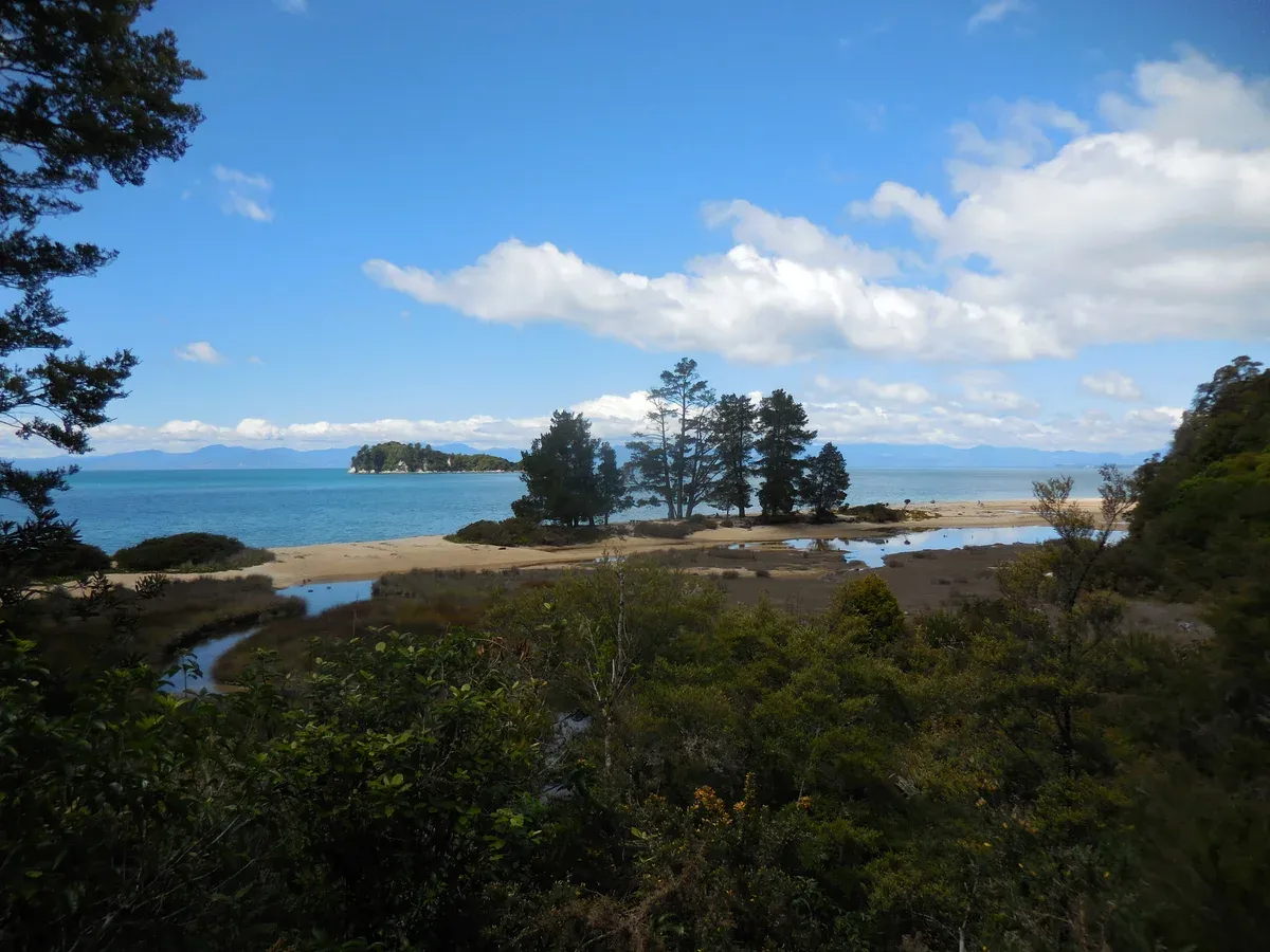
Apple Tree Bay and Fisherman Island appear through the bush on the walk north from Marahau. Photo: David Broad, CC BY 3.0, via Wikimedia Commons
Abel Tasman Coast Track Questions
Can I take a dog on the Abel Tasman Coast Track?
No, DOC says dogs are not allowed in Abel Tasman National Park. Guide dogs are permitted everywhere.
Is the Abel Tasman Coast Track good with kids?
Children have lower hut fees, from $28 for a NZ child aged 5 to 17, and infants aged 0 to 4 stay free at New Zealand rates. Walking days run 4 to 6 hours, so a day walk with a boat suits younger children better. Browse abel tasman national park tours for boat-plus-walk days.
Is there an Abel Tasman Coast Track map?
DOC offers a free Abel Tasman visitor app that works offline, and the section table above gives the distances.
What are the Abel Tasman walk packages?
Packaged options include the 3-Day Fully Guided Catered Kayak and Camping Tour at $755 per person and the Abel Tasman: Self-Guided 3-Day Kayak and Walk at $184 per person.
Can I kayak part of the Abel Tasman Coast Track?
DOC gives paddling times for experienced paddlers in calm conditions as Marahau to Anchorage 4 hr, Anchorage to Bark Bay 2 hr and Bark Bay to Onetahuti 1 hr 30. Kayaking is not recommended north of Onetahuti, and independent rentals need two people with sea-kayak experience.
Is there a 3 day Abel Tasman walk?
Yes, the 3 Day Abel Tasman Guided Walk runs 3 days and 2 nights. A shorter 3 day plan on foot is possible because DOC gives 3 to 5 days.
More Guides
- Abel Tasman Accommodation: Where Should You Stay for the Park?
Huts, campsites, Awaroa Lodge and gateway towns for 2027. 4 huts, 18 campsites, 67 km from Nelson. Pick the base that fits your trip.
- Abel Tasman Weather: When Is the Best Time to Visit?
Abel Tasman weather by month: 6 to 12 rainy days, highs of 13 to 23°C and calm autumn seas. Pick your best month and plan your 2027 trip.
- Kaiteriteri: How Do You Start an Abel Tasman Trip from Here?
Kaiteriteri is 61 km from Nelson by road. See the beach basics and the boat trips that leave from here. Pick yours for 2027.